There will be some graphs representing the data contained in the gps file.
The layout of the gps page will be flexible, i.e. you will be able to change the dimensions of the page, to re-size the map and the graphs, to choose how many graphs you want to see, where, etc etc.
As pictures speak better than words, here some screenshots of the progressing work
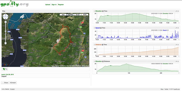
An overview of the new interface
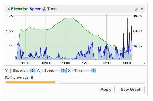
A graph detail
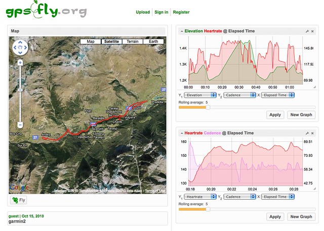
Some new graph types, just added today
No comments:
Post a Comment